
earthdiff
Satellite eyes for AI assistants: what changed here? Free Sentinel-2 imagery, no account or API key.
- tools
- 4
- transport
- STDIO
- env vars
- 2
- last updated
- Nov 12, 2026
Tools
4 toolsPublic tool metadata for what this MCP can expose to an agent.
find_placePlace name to bounding box(es). Several different places: returns candidates, never guesses. Box over the area limit: returns a centred box and tiles to choose from. Nominatim policy: User-Agent, at most 1 request/s, cache, attribution. margin_km adds the surroundings.
Place name to bounding box(es). Several different places: returns candidates, never guesses. Box over the area limit: returns a centred box and tiles to choose from. Nominatim policy: User-Agent, at most 1 request/s, cache, attribution. margin_km adds the surroundings.
No parameter schema in public metadata yet.
plan_changeValidates area and windows, searches scenes, downloads nothing. Scene counts and dates, grid size, expected runtime, warnings.
Validates area and windows, searches scenes, downloads nothing. Scene counts and dates, grid size, expected runtime, warnings.
No parameter schema in public metadata yet.
detect_changeThe analysis (reuses the same pipeline as earthdiff run). Images, hectares and polygons per class, likely_cause hint for vegetation loss, optional seasonal_check, comparable share, confidence, bright-surface check, data quality, largest areas, warnings, file paths.
The analysis (reuses the same pipeline as earthdiff run). Images, hectares and polygons per class, likely_cause hint for vegetation loss, optional seasonal_check, comparable share, confidence, bright-surface check, data quality, largest areas, warnings, file paths.
No parameter schema in public metadata yet.
explain_methodThe rules with thresholds, pipeline, how confidence is computed, limits, data and attribution.
The rules with thresholds, pipeline, how confidence is computed, limits, data and attribution.
No parameter schema in public metadata yet.
Sponsors
 Agent CaffeineSponsoredClose your lid, come back to finished work
 SnugSponsoredThe clipboard manager for the AI eraPromote your product hereReach 125k+ visitors monthly
 WaxSponsoredBlock anything with supervision, without erasing your iPhonePromote your product hereReach 125k+ visitors monthly
 knobsSponsoredSee your site on any phone, any day, in any language
Configuration
EARTHDIFF_OUTPUT_DIRFolder where reports and images are written (default ~/earthdiff-mcp-output).
EARTHDIFF_MAX_AREA_KM2Largest area one analysis may cover, in km2 (default and maximum 2000; set it lower to limit run time).
Readme
earthdiff
Satellite eyes for your AI assistant: "what changed here?" answered from free Sentinel-2 imagery, with before/after images, a change map, hectares, confidence and limits. No account, no API key, no paid service, no black-box model. Works as an MCP server (Claude Desktop, Claude Code, Cursor, any MCP client) and as a command line tool.
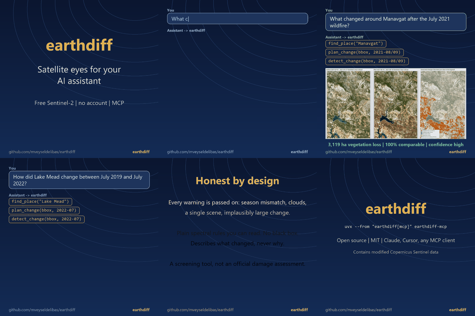
The GIF is built by scripts/make_demo_gif.py from the literal outputs of the MCP tools (validation/mcp/).
Try a report in your browser, nothing to install: example report, Manavgat August 2020 vs August 2024 (swipe, scene by scene, 3D, searchable table; Turkish and English).
Türkçe: MCP kurulumu ve kullanım aşağıda
Use it from your AI assistant in 30 seconds
Details
- Repository
- github.com/mveyseldelibas/earthdiff
- Package
earthdiff- Transport
- STDIO
- Registry
- MCP registry, active